
To Missoula on the Northern Parks Ltd.
Friday May 26 - Flathead Lake and Glacial Lake Missoula
After lunch we continued driving along the west shore of Flathead Lake, which is the largest body of freshwater west of the Great Lakes It's maximum depth is 370 Ft., and it rarely freezes. Scott explained how the introduction of mysis shrimp in the early 1980s vastly increased the numbers of lake trout and whitefish who fed on the shrimp, but caused the collapse of the kokanee salmon, whose food the shrimp ate. Along here we saw occupied Osprey nests on the tops of old power poles.
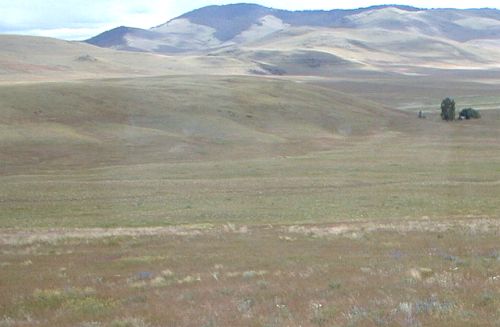
After passing the town of Elmo, we drove on SR 28 through a region whose topology was formed by glacial Lake Missoula. Scott had the bus driver pull off onto a long gravel road so that we could observe undulations or ripple marks in the land, which were caused by a cataclysmic rush of huge volumes of water released when the glacial dam ruptured.
The bus driver had quite a challenge turning the bus around because of barbed wire fences along both sides of the road. We finally came to a gate that provided a turnaround spot. This gravel road was very smooth and had no potholes - it was much better than most Pennsylvania roads.


Related Links:
Richard and Margaret Batterman